Check out 5 of the most beautiful spots around the NSW Blue Mountains your 4×4 can take you.
Those of us in NSW might need to stick to the state for our next adventure when we get to head out again. But that’s OK when you’ve got access to these stunning vistas!
Mount Hay Road

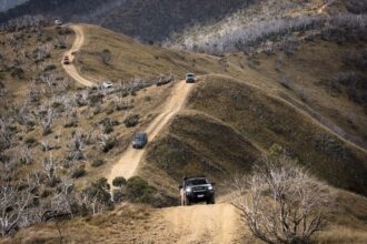
Mount Hay is a beacon to the adventurous. Its 945m basalt-capped dome summit is a distinctive feature when you gaze westward from Sydney. In 1789 a party led by Lieutenant William Dawes crossed the Nepean River with orders from Governor Arthur Phillip to reach Mount Hay. They didn’t get very far. Drive to the end of Mount Hay Road today and look east, back towards Sydney, and you still see the wild country that defeated Dawes and so many others who tried to cross these mountains. Look north and west and you are peering into the cliff-lined official wilderness of the mighty Grose Valley. Mount Hay Road extends about 20km north from the village of Leura and was constructed as a fire trail in 1959. It is such a spectacular stretch of unsealed road that Mazda shot its BT50 ute ad there years ago. Mountain bikers and hikers alike are in for a treat there. The walks range from short and easy (Flat Top, Butterbox Point) to more challenging (Lockleys Pylon, into the Grose Valley, the summit of Mount Hay). Mount Hay Road is also a gateway to two popular canyons – Fortress and Butterbox.
Six Foot Track

This 45km trail between Katoomba and Jenolan Caves was once a bridal track in 1884 and it was six feet wide so that two horses could safely pass each other. These days, 20km of the track between Coxs River and Jenolan Caves Road is also a dirt road accessible to 4WDs. There’s a good camping ground beside the Coxs and it’s the same river Charles Darwin sat beside in 1836 watching platypus – an experience that inspired him to write in his diary that day, for the very first time, the first glimpse of what was to become his famous theory, On the Origin of Species by Means of Natural Selection. About a kilometre upstream from the camping area there’s a narrow, steel, Indiana Jones-style swing bridge strung high across this gorgeous river that never fails to thrill. Highlights of the drive include three crossings of Little River (a good trout fishing stream) and the long, steep climb to the top of Cronje Mountain (named after a notorious wild stallion that was in turn named after a cunning Boer War general). Once you are back on the bitumen, be sure to visit Jenolan Caves, the oldest on earth.
Wolgan Valley

Thanks to the ultra-exclusive Wolgan Valley Resort, there’s not as much unsealed road in the valley as there used to be. It’s still a beautiful drive on dirt beside the Wolgan River to the old shale mining town of Newnes, nestled beneath towering sandstone cliffs. There’s great camping near the old Newnes pub (unlicensed these days) or inside Wollemi National Park. The ruins of the shale mining complex (one of Australia’s more ambitious industrial projects) are fascinating, while for those feeling more adventurous there’s canyons and the walk over Pipeline Pass into the neighbouring Capertee Valley. This is also a great place for spotting wildlife, particularly wombats.
Newnes Plateau

Not far from Lithgow, turn off the bitumen where the now closed Zig Zag Railway is to hit a network of unsealed roads that lead to great bush walks, canyons, camping areas, Aboriginal art and the famous Glow Worm Tunnel. The tunnel, several hundred metres long, was built more than a century ago as part of the railway line to serve the shale works at Newnes. When the steam trains moved out, the glow worms moved in.
Kings Tableland

Turn into Tablelands Road at Wentworth Falls and you will soon find yourself on an unsealed road that snakes more than 20km to McMahons Lookout. There you will be rewarded with spectacular views over the southern Blue Mountains and the backwaters of Lake Burragorang. The road sits on top of Kings Tableland, an ancient sandstone ridge that was a superhighway for the Gundungurra people travelling between the Burragorang and lower Coxs valleys to the ridge tops of the upper Blue Mountains. On Kings Tableland you can visit tool sharpening grooves and a rock shelter where the oldest known Aboriginal occupation of the mountains has been dated back 22,000 years. For the white settlers of the lower Coxs River, whose farms are now drowned by Lake Burragorang, Kings Tableland was also their access to civilisation. To get their pigs to market in Sydney they would walk them along the ridge to the railway station at Wentworth Falls, enticed by cobs of corn laid out in front of them. From Kings Tableland you can branch off to Ingar swimming hole and camp ground, the mighty Wentworth Falls, awesome downhill mountain biking on the Andersons fire trail, bushwalking to the Kedumba River and Mount Solitary via precipitous Kedumba Pass, or take in a golden sunset over the Jamison Valley from Lincolns Rock, named after the Australian mountaineer Lincoln Hall of Everest fame, who lived nearby.
So check out these 5 beautiful spots next time you’re adventuring through the Blue Mountains, or why not plan your trip around them?


This is a really helpful article, thank you for sharing these great locations, hopefully going to discover the Mount Hay one over the next few weeks!